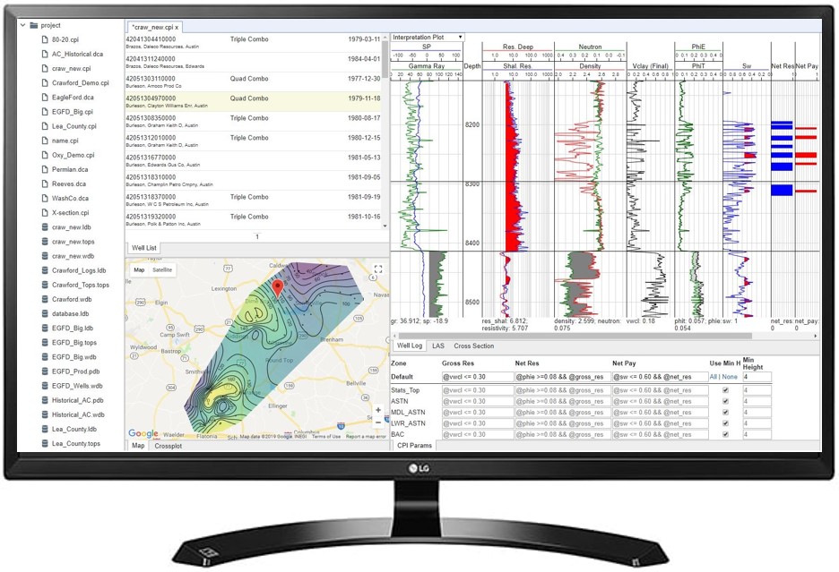
Danomics Petrophysics is a cloud-based, multi-well petrophysical mapping package that gives geologists and engineers the tools they need to integrate robust petrophysical workflows into their day-to-day mapping and interpretations. Our software streamlines and automates log analysis so that every well in your data set receives its own, custom interpretation. From regional evaluations to the prospect level our software accelerates and enhances understanding of the subsurface.
Visually-driven, drag-and-drop interfaces and real-time updates with zone-by-zone and well-by-well parameter selection, combined with fit-for-purpose QC tools, means that you can quickly generate interpretations, identify and fix problem wells, and deliver results.
Petrophysical Workflows
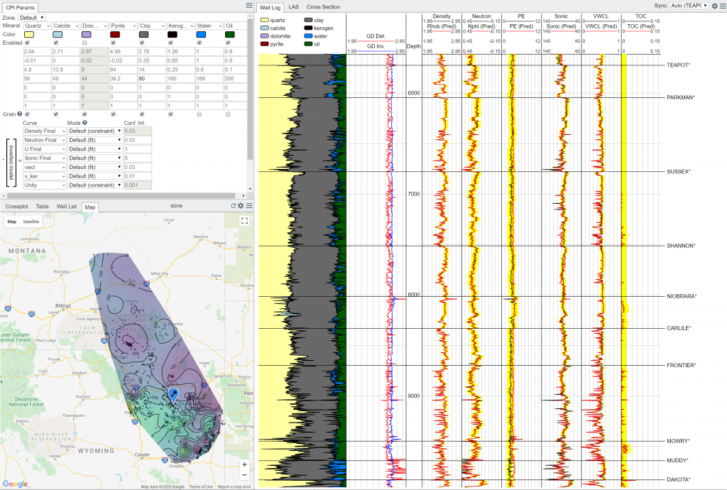
Danomics’ Petrophysics uses industry-standard workflows that navigate users through a series of modules for bad hole, clay volume, TOC, mineral inversion for grain density, porosity, saturation, and cutoffs analysis using pre-built, customizable templates with associated parameter selection and entry menus.
Our workflows are flexible, customizable, and extensible so petrophysical staff can tailor them to meet your company’s specific requirements and constraints. With access to our petrophysics equation engine and integrated Python you can build truly innovative workflows.
To learn more about the full range of modules, please see our Petrophysics help documentation page.
Multi-well Interpretations
Danomics Petrophysics lets you scale your interpretations from a single-well to the basin scale. We provide you with a number of specialized tools to enable effective multi-well petrophysics. These include:
- Interpretation blueprints
- Mineral inversion modeling 30-50x faster than competitors
- Grid-based parameter interpolation for spatially varying properties
- Automated data conditioning and repair that gets your data Interpretation Ready from day one.
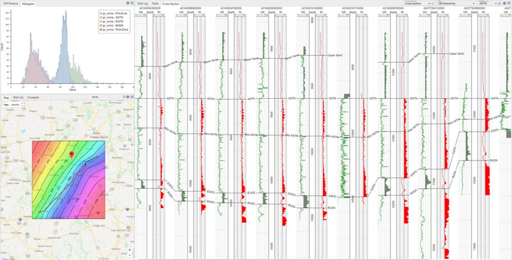
Our tools let you navigate through the data using well lists, maps, and cross-sections with search and filtering functionality allows you to rapidly locate the relevant wells.
Mapping and Cross-section Tools
The platform includes access to built in cross-sections and mapping tools. You can build your stratigraphic framework, interpret, and map the results. Our multi-grid mapping tools allow you to grid multiple properties for multiple zones in a single run. Our cross-section tools allow you to make structural and stratigraphic cross-sections with 100s-1000s of wells that can be instantly updated and redrawn instead of having to wait for minutes on changes and rescaling like in other packages.
Oil & Gas Powered by the Cloud
Danomics’ software is cloud-native and delivered entirely through the web browser. You can access your projects, data, and workspace where you are. Why cloud-based?
- By leveraging cloud-infrastructure and data centers we can instantly and automatically scale up computing power to handle the largest of projects.
- Moving to the cloud means your projects are wherever you are. No more worrying about moving licenses between computers, carrying around security dongles, or performance lag when connecting to remote desktops
- Cloud computing eliminates the necessity of purchasing and maintaining high-end workstations. Our software can be run on any device with access to an internet connection.
Cloud is the future of oil and gas and Danomics is leading the way. Contact us at sales@danomics.com for licensing information, to arrange a demo, or to start your free trial.
Have questions? Contact us to learn how Danomics Petrophysics software can start powering your subsurface evaluations today.